Weather Alert: Heavy Rain and Thunderstorms Expected in Maharashtra on Saturday, IMD Issues Yellow Alert for 3 Districts
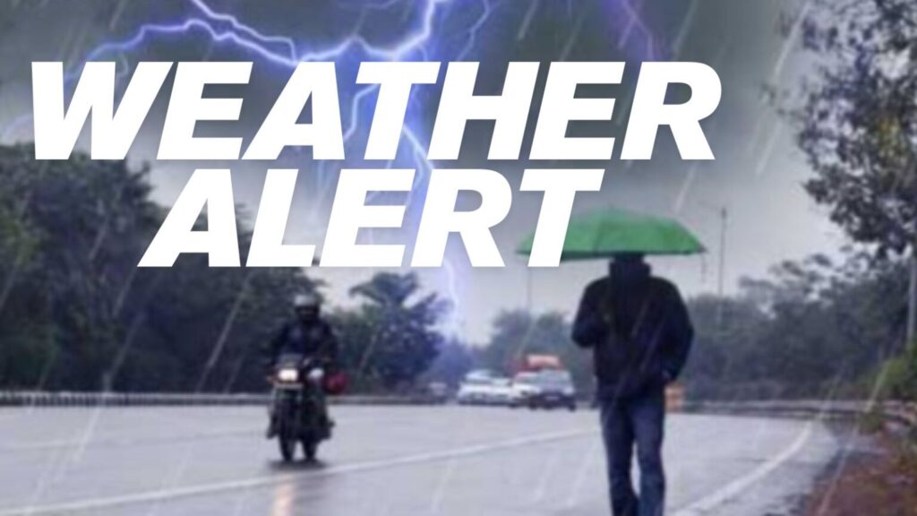
Pune, October 17, 2025: The India Meteorological Department (IMD) has issued a weather alert for Maharashtra, predicting thunderstorms and heavy rainfall accompanied by gusty winds in several parts of the state on Saturday, October 18.
Despite the withdrawal of the southwest monsoon, favourable weather conditions have led to continued rain activity across different regions.
According to the IMD, Sindhudurg, Kolhapur, and Satara districts are under a yellow alert, with forecasts indicating thunderstorms, lightning, and strong winds up to 40 km/h. In Mumbai and its suburbs, skies are expected to remain partly cloudy, with chances of light to moderate rain and thunder in the evening or night. Rain is also likely in Raigad and Ratnagiri districts. In western Maharashtra, Kolhapur and Satara may witness heavy rainfall, while Pune, Sangli, and Solapur could experience light to moderate showers along with gusty winds. For north Maharashtra, no major alerts have been issued, though Nashik and Ahmednagar might receive isolated rainfall. The remaining districts — Dhule, Nandurbar, and Jalgaon — are expected to have mainly clear skies.
In Marathwada, Beed, Dharashiv (Osmanabad), and Latur may experience scattered thunderstorms, while Parbhani, Jalna, Chhatrapati Sambhajinagar, Hingoli, and Nanded are likely to remain mostly clear. Vidarbha, on the other hand, will continue to see dry weather and clear skies across all 11 districts.
The IMD further noted that light to moderate rainfall may continue in parts of Maharashtra until October 21, with Parbhani, Hingoli, and Nanded placed under a yellow alert on that date.
Additionally, rainfall is also expected in some Konkan and western Maharashtra districts on October 19 and 20. Maharashtra Weather: Sudden Showers Bring Relief to Mumbai, Navi Mumbai, and Thane—More Rain Likely Ahead, Says IMD

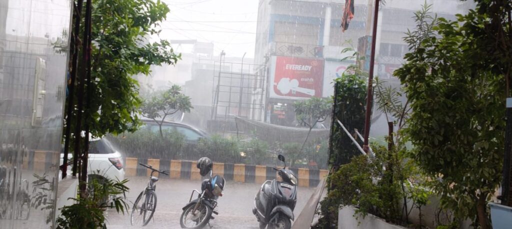
Maharashtra Weather: Sudden Showers Bring Relief to Mumbai, Navi Mumbai, and Thane—More Rain Likely Ahead, Says IMD After days of scorching heat and dry skies, the weather finally took a welcome turn in parts of Maharashtra on the evening of October 16. Unexpected yet much-needed rainfall drenched areas of Thane and Navi Mumbai, breaking the spell of humidity and offering some respite to residents. The showers, which were accompanied by thunder in several localities, came as a surprise for many who were grappling with rising temperatures and stagnant air.
The India Meteorological Department (IMD) had already issued a Yellow Alert for Mumbai’s satellite cities—Navi Mumbai and Thane—as well as for the Raigad and Ratnagiri districts. According to the department, the rainfall is part of a larger weather pattern affecting the region. Forecasts had indicated a possibility of thunderstorms with lightning, light to moderate rain, and gusty winds blowing at speeds of 30 to 40 kilometers per hour in isolated locations. These predictions have largely played out on the ground, confirming the growing activity in the atmosphere.
Weather experts explain that a low-pressure area has formed near the southern tip of India, and this system is gradually moving in a northwesterly direction. As a result, rising moisture levels are being observed across Mumbai, Pune, and other parts of western Maharashtra. This increase in humidity is expected to bring on-and-off spells of rain over the next several days. Residents in neighborhoods such as Mulund, Thane, and Powai reported heavy downpours during the evening hours, with many also hearing loud thunderclaps. The sudden weather change brought not just cool winds but also excitement among locals, who quickly took to social media to share videos and pictures of the rainy scenes in their areas. The joy was palpable as the rains cut through the oppressive heat that had settled over the city.
Looking ahead, meteorologists believe that this weather system will continue to impact the coastal Konkan belt and areas near the Western Ghats. In fact, the coming week is likely to bring more frequent spells of rain and thunderstorms across these regions. The IMD has predicted that maximum temperatures will hover around 35°C, while minimum temperatures are expected to stay close to 24°C over the next few days.
Adding to this, a cyclonic circulation has developed in the upper levels of the atmosphere over the Arabian Sea, further supporting conditions for light to moderate rainfall. Given these evolving patterns, the IMD has extended a Yellow Alert to all districts in Maharashtra—except Vidarbha—for various dates between October 15 and 17. This alert is a cautionary measure aimed at keeping the public informed and prepared.
IMD Weather Alert: Maharashtra
Issued by IMD, Nagpur | Saturday, October 18, 2025, 12:30 PM IST Yellow Alert: Heavy Rain & Thunderstorms Expected
A Yellow Alert is in effect until 11:00 PM tonight. Conditions are favorable for significant rainfall and thunderstorm activity. Residents in affected areas should “Be Aware” and anticipate potentially disruptive weather.
Affected District Forecasts
A Yellow Alert has been issued for three districts. Select a district below to view the specific forecast, including details on rainfall, wind, and potential hazards.
Nagpur
Forecast for Nagpur
Nagpur: Expect moderate to heavy rainfall, with one or two intense spells possible. Thunderstorms accompanied by lightning and gusty winds (30-40 km/h) are likely. Waterlogging in low-lying urban areas is possible.
- Rainfall: Expect moderate to heavy rainfall, with one or two intense spells possible.
- Thunderstorms: Likely, accompanied by lightning.
- Wind: Gusty winds reaching 30-40 km/h are expected.
- Potential Hazards: High possibility of waterlogging in low-lying urban areas.
Nagpur Lashed by Heavy Rain with Thunder and Lightning September 15, 2025
The city witnessed a spell of intense rainfall around 2 p.m. on Monday, accompanied by loud thunderclaps and frequent lightning strikes. The sudden downpour brought relief from the sweltering heat but also caused temporary disruption in daily activities. According to residents, dark clouds gathered over the city by early afternoon, followed by a burst of heavy showers. The rain, coupled with strong thunder and lightning, lasted for nearly an hour in several areas. While it brought down the day’s temperature marginally, the accompanying rise in humidity levels left the atmosphere heavy and uncomfortable. Traffic movement slowed down on major routes, with commuters taking shelter under flyovers, bus stops, and shops. Some low-lying areas reported minor waterlogging, though there were no major reports of disruption to civic services. Weather experts have noted that such intense rain spells during September are a result of lingering monsoon activity, often marked by high moisture levels and local atmospheric instability. Citizens have been advised to remain cautious during thunder and lightning, especially avoiding open fields and tall structures.
Threat Comparison
This chart provides a visual comparison of the primary threats—rainfall intensity and maximum wind speed—across the districts currently under a yellow alert.
Wardha
Forecast for Wardha
- Rainfall: Widespread rain expected, with heavy downpours in short periods.
- Thunderstorms: Predicted to develop later this afternoon.
- Wind: Strong wind gusts are possible during thunderstorms.
- Potential Hazards: Primary concerns are flash flooding from heavy downpours and frequent lightning strikes.
General Forecast for Maharashtra
While some districts are on high alert, other regions will experience milder weather. Click on a region below to see the general forecast for those areas.Vidarbha Region+Marathwada & Central Maharashtra+Konkan & Goa+
Safety Advisories & Precautions
In light of the forecast, please take the following precautions to ensure your safety and the safety of those around you.
🏠
Stay Indoors
It is advisable to remain indoors during thunderstorms and heavy rain to avoid risks from lightning and strong winds.
🚗
Avoid Unnecessary Travel
If possible, postpone travel plans in the affected districts until the weather improves to avoid hazardous road conditions.
💧
Check for Waterlogging
Be cautious of flooded roads and underpasses. Do not attempt to drive or walk through heavily waterlogged areas.
🌬️
Secure Loose Objects
Ensure items outdoors like flower pots or furniture are secured to prevent them from being blown away by gusty winds.
🔌
Unplug Electronics
To protect against power surges from lightning, unplug non-essential electronic devices and appliances.
📡
Follow Official Updates
Continuously monitor updates from the IMD and local authorities for the latest information and instructions.
Stay safe and informed.
Forecast for Bhandara
- Rainfall: High probability of moderate rainfall throughout the evening.
- Thunderstorms: Likely, with associated lightning.
- Wind: Be cautious of strong, sudden wind gusts.
- Potential Hazards: Risk of localized flooding in vulnerable areas.
Threat Comparison
This chart provides a visual comparison of the primary threats—rainfall intensity and maximum wind speed—across the districts currently under a yellow alert.
General Forecast for Maharashtra
While some districts are on high alert, other regions will experience milder weather. Click on a region below to see the general forecast for those areas.Vidarbha Region+Marathwada & Central Maharashtra+Konkan & Goa.
Vidarbha Region
Other districts in the Vidarbha region will likely experience scattered showers and generally overcast skies. Widespread heavy rain is not anticipated.Marathwada & Central Maharashtra.
Light to moderate rain is possible in isolated areas. Most of the region will remain cloudy but without significant rainfall.Konkan & Goa
Coastal areas will see partly cloudy skies with a low chance of light evening showers. Major weather disturbances are not expected.
IMD Weather Alert: Maharashtra
Issued by: India Meteorological Department (IMD), Regional Centre, Nagpur Date and Time of Issue: Saturday, October 18, 2025, 12:30 PM IST
Overview: Heavy Rain & Thunderstorms Expected Today
As of Saturday afternoon, conditions are favorable for significant rainfall and thunderstorm activity across parts of Maharashtra. A low-pressure system combined with available atmospheric moisture is expected to trigger moderate to heavy showers throughout the late afternoon and evening.
Yellow Alert Issued for Three Districts
A Yellow Alert is in effect until 11:00 PM tonight for the following districts, indicating a need to “Be Aware.” Residents in these areas should anticipate potentially disruptive weather conditions.
Bhandara: Similar conditions are expected, with a high probability of thunderstorms and moderate rainfall. Residents should be cautious of localized flooding and strong wind gusts.
The city witnessed a spell of intense rainfall around 2 p.m. on Monday, accompanied by loud thunderclaps and frequent lightning strikes. The sudden downpour brought relief from the sweltering heat but also caused temporary disruption in daily activities. According to residents, dark clouds gathered over the city by early afternoon, followed by a burst of heavy showers. The rain, coupled with strong thunder and lightning, lasted for nearly an hour in several areas. While it brought down the day’s temperature marginally, the accompanying rise in humidity levels left the atmosphere heavy and uncomfortable. Traffic movement slowed down on major routes, with commuters taking shelter under flyovers, bus stops, and shops. Some low-lying areas reported minor waterlogging, though there were no major reports of disruption to civic services.
For any period of heavy rainfall, here is important information to keep in mind:
Forecast and conditions
- Moderate to heavy rainfall: The intensity of rain can lead to significant accumulation in a short time.
- Thunderstorms: Expect loud thunder and frequent lightning strikes accompanying the downpour.
- Gusty winds: Strong winds, potentially reaching speeds of 30–40 km/h, are likely and can make driving difficult.
- Waterlogging: Low-lying areas are at risk of waterlogging, which can cause traffic disruptions and inconvenience for commuters.
Heavy rain lashes city, roads waterlogged, traffic affected
Updated: Aug 20, 2025, 22:05 IST

Nagpur: A spell of intense rain that began past midnight and continued for most part on Tuesday led to flooded streets and disrupted vehicular traffic in the morning hours putting school, college students, and office goers to inconvenience. The city recorded 91.4mm rainfall on Tuesday.Traffic was disrupted as water entered railway underpasses in various parts of the city, especially at Narendra Nagar and Manish Nagar, triggering traffic jams. The situation gradually improved towards afternoon, but heavy rain also occurred around 6pm.India Meteorological Department (IMD) has forecast partly cloudy sky with possibility of development of thunderstorm accompanied with lightning for Wednesday.The Regional Meteorological Centre at Nagpur has issued a red alert for Chandrapur district, predicting extremely heavy rainfall at some places, while an orange alert has been issued for Nagpur, Gondia, Gadchiroli and Wardha districts with heavy to very heavy rainfall warning in the 24hours ending 8.30am on Wednesday.
General Forecast for the Rest of Maharashtra
- Vidarbha Region: Other districts in the Vidarbha region will likely experience scattered showers and overcast skies.
- Marathwada & Central Maharashtra: Light to moderate rain is possible in isolated areas, but widespread heavy rainfall is not expected.
- Konkan & Goa: Coastal areas will see partly cloudy skies with a chance of light evening showers.
Safety Advisories and Precautions
- Stay Indoors: It is advisable to remain indoors during thunderstorms.
- Avoid Unnecessary Travel: If possible, postpone travel plans in the affected districts until the weather subsides.
- Check for Waterlogging: Be cautious of flooded roads and underpasses. Do not attempt to drive through heavily waterlogged areas.
- Secure Loose Objects: Ensure any loose items outdoors (e.g., flower pots, signage) are secured to prevent damage from gusty winds.
- Unplug Electronics: To protect against power surges from lightning, unplug non-essential electronic devices.
- Follow Official Updates: Continue to monitor updates from the IMD and local authorities.
Please stay safe and informed.