The India Meteorological Department (IMD) said in a release that conditions are favourable for further advance of the southwest monsoon into some more parts of the North Arabian Sea and some areas of Uttar Pradesh and Uttarakhand, among other States, during the next two to three days.
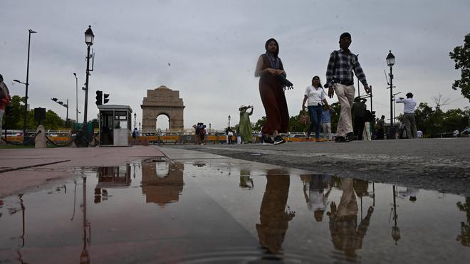
According to weather forecasting agency Skymet, Delhi is likely to see the arrival of monsoon on July 4 if conditions remain favourable. Conditions are favourable for further advance of the southwest monsoon into several northern States over the next five to six days, the IMD said on Sunday (June 28, 2026), even as the national capital recorded its warmest morning in two years amid the delayed seasonal rainfall. When will monsoon reach Delhi, north India? IMD says wait may be over in 5-6 days an unusually hot spell and a delayed onset of the southwest monsoon, Delhi and several parts of north India may finally be in for relief.
")
According to the IMD, the monsoon is expected to cover more parts of the North Arabian Sea, Uttar Pradesh and Uttarakhand over the next two to three days.
When will Delhi receive rainfall?
Private weather forecaster Skymet said Delhi is likely to receive the monsoon by July 4 if conditions remain favourable.
The weather agency attributed the delay to the interaction of dry westerly winds from Pakistan and moisture-laden southwesterly winds from the Arabian Sea, a combination that has pushed up both temperatures and humidity without producing widespread rainfall, the PTI report added.
Expert explains Delhi weather
“Normally, the monsoon reaches Delhi around June 27-28. This year, however, it is likely to be delayed by about a week,” Mahesh Palawat, Vice President (Meteorology and Climate Change), Skymet, said.
Explaining the prevailing weather, Palawat said dry and moist air masses have been interacting over Delhi, leading to cloud formation but insufficient moisture for widespread rain.
Since the clouds typically develop only in the late afternoon, after the day’s peak temperature has already been recorded, both the actual and “feels-like” temperatures have remained unusually high.
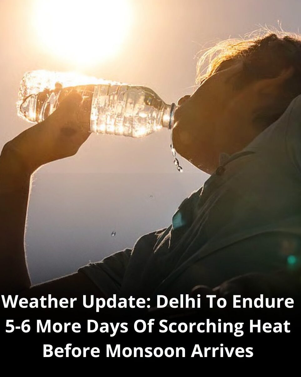
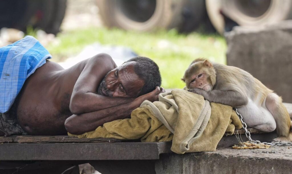
Delhi continued to swelter on Sunday, recording its warmest morning in two years. The minimum temperature settled at 31.1 degrees Celsius, 3.2 degrees above normal, while the maximum climbed to 41.8 degrees Celsius. According to the IMD, the city experienced heatwave conditions, with the “feels-like” temperature touching around 50.7 degrees Celsius at 5.30 pm. Thunderstorms accompanied by rain have been forecast for Monday.
The IMD has also warned of heatwave conditions, which could be severe, in parts of Uttar Pradesh on June 28 and 29. Prayagraj recorded a maximum temperature of 43.4 degrees Celsius, while Lucknow touched 39.7 degrees Celsius, 3.6 degrees above normal.
Thunderstorms accompanied by lightning and gusty winds are also likely at isolated places in eastern Uttar Pradesh.
Expected weather in Shimla and J&K
Elsewhere, the meteorological centre in Shimla forecast a wet spell in Himachal Pradesh till July 4 as a fresh western disturbance is expected to affect northwest India from July 2. A thunderstorm alert with gusty winds of 30-40 kmph has been issued for isolated places between June 30 and July 4. Light rain and thunderstorms were reported from parts of Shimla, Kangra and Mandi over the past 24 hours. In Jammu and Kashmir, Srinagar recorded a maximum temperature of 33.8 degrees Celsius, 3.8 degrees above normal, while Jammu touched 37 degrees Celsius.
The weather office has forecast pre-monsoon showers over the Jammu plains on June 29, with heavy rain, thunderstorms and gusty winds expected at isolated places. Delhi, officially the National Capital Territory (NCT) of Delhi, is a megacity and a union territory of India containing New Delhi, the capital of India. Explore Delhi, India’s bustling capital and largest city. Find out about its rich history, attractions, shopping, events, and more. Home Government of National Capital Territory of Delhi Main navigation · Search · Latest News · News and Updates · Quick Links.
Immediate Regional Weather Updates
- Delhi Forecast: The national capital just endured its warmest morning in two years, recording a minimum temperature of 31.1°C (3.2 notches above normal) and a maximum of 41.8°C. Relief from the intense humidity and heat is expected to pick up later this week. IMD says monsoon set to advance across north India in next 5-6 days; Delhi swelters under intense heat conditions are favourable for the southwest monsoon to advance across several northern states over the next five to six days, even as Delhi recorded its warmest morning in two years and Uttar Pradesh remained under heatwave conditions. Rain, thunderstorms and gusty winds are expected to bring gradual relief across parts of north India later this week.
Conditions are favourable for further advance of the southwest monsoon into several northern states over the next five to six days, the IMD said on Sunday, even as the national capital recorded its warmest morning in two years amid the delayed seasonal rainfall. The India Meteorological Department (IMD) said in a release that conditions are favourable for further advance of the southwest monsoon into some more parts of the North Arabian Sea and some areas of Uttar Pradesh and Uttarakhand, among other states, during the next two to three days.
It is likely to continue its movement over some more parts of Uttar Pradesh, Uttarakhand, some areas of Himachal Pradesh, Jammu and Kashmir, Ladakh and southeast Rajasthan during the subsequent two to three days. It is likely to continue its movement over some more parts of Uttar Pradesh, Uttarakhand, some areas of Himachal Pradesh, Jammu and Kashmir, Ladakh and southeast Rajasthan during the subsequent two to three days. However, it also warned of heatwave conditions — possibly severe — in Uttar Pradesh on July 28 and 29.
According to weather forecasting agency Skymet, Delhi is likely to see the arrival of monsoon on July 4 if conditions remain favourable. Meanwhile, recording its warmest morning in two years, Delhi’s minimum temperature settled at 31.1 degrees Celsius, 3.2 notches above the seasonal average, while the maximum climbed to 41.8 degrees Celsius.
The last time the city’s minimum temperature was higher was on June 14, 2024, when it was recorded at 33.3 degrees Celsius. According to the weather office, a heatwave has been realised over Delhi, and the “feels-like” temperature at 5.30 pm, as calculated by the IMD, was around 50.7 degrees Celsius. For Monday, however, it forecast thunderstorms with rain.
Skymet said the delay in the onset of the monsoon and the interaction of dry and moist winds have kept both temperatures and humidity unusually high.
“Normally, the monsoon reaches Delhi around June 27-28, after which temperatures begin to ease and humidity increase. This year, however, the monsoon is likely to be delayed by about a week. Dry westerly winds from Pakistan are keeping temperatures high, while southwesterly winds from the Arabian Sea are also reaching Delhi and increasing humidity,” Mahesh Palawat, Vice President (Meteorology and Climate Change), Skymet, said. “When these dry and moist air masses interact, clouds do form, but there is not enough moisture for widespread rainfall. By the time cloud formation takes place, usually around 4 or 5 pm, the day’s maximum temperature has already been recorded. That is why both the maximum temperature and the ‘feels-like’ temperature have remained unusually high,” he said.
The meteorological centre in Shimla predicted a wet spell in Himachal Pradesh till July 4, saying a fresh western disturbance is likely to a to affect northwest India from July 2 onwards.
It issued an alert for thunderstorms and gusts of 30-40 kmph in isolated place in the state between June 30 and July 4. Light rains were witnessed in parts of the state in the 24 hours since Saturday evening, and Shimla, Kangra and Mandi districts witnessed thunderstorms.
Meanwhile, in Uttar Pradesh, mercury soared to 43.4 degrees Celsius in Paryagraj, while Lucknow recorded a maximum temperature of 39.7 degrees Celsius, 3.6 notches above normal, the meteorological department said.
The isolated parts of the state are very likely to witness a heat wave in the next 24 hours, the department said, adding that thunderstorms/lightning accompanied by gusty winds are very likely at isolated places over eastern Uttar Pradesh. In Jammu and Kashmir, Srinagar recorded a maximum temperature of 33.8 degrees Celsius, 3.8 degrees above normal, and a minimum of 19.7 degrees Celsius, 2.6 degrees above normal. For Jammu, the maximum stood at 37 degrees, and the minimum was 3.8 notches below normal at 22.5 degrees Celsius.
The weather office said pre-monsoon showers in the plains of Jammu and adjoining areas were likely on June 29 and forecasted intense heavy showers, thunder and gusty winds at a few places.
Noting that the temperatures have remained appreciable above normal in several parts of Uttarakhand, the Dehradun Meteorological Centre issued a yellow (watch) morning for thunderstorm accompanied with lightning, an intense to very intense spell of rain and gusty winds at isolated places in hilly districts of Uttarakhand.
Dehradun registered a maximum temperature of 37.1 degrres Celsius, which was five degrees above normal, and a minimum of 26.8 degrees, which was three notches above normal.
For Punjab and Haryana, the IMD predicted scattered rainfall on June 29 and July 1 and 2 even as temperatures remained above-normal in several parts. The two states are also likely to witness thunderstorm, lightning and gusty winds (with speed reaching 40-50 kmph, gusting to 60 kmph) between July 1 and 4.
In Rajasthan, humid weather conditions persisted across large parts, even as scattered rainfall was reported in several districts, including Pilani in Jhunjhunu district, which saw 7 mm of rain since morning.
The meteorological office has predicted moderate to heavy rainfall accompanied by thunderstorms in parts of the Kota and Udaipur divisions over the next few days, with rainfall activity expected to increase across southeastern and eastern Rajasthan from July 2.
Uttar Pradesh Timeline: The monsoon is expected to enter some areas of Uttar Pradesh and Uttarakhand within the next two to three days. However, the IMD has concurrently issued warnings for severe heatwave conditions in parts of Uttar Pradesh. ‘Wait for monsoon may be over in 5-6 days’ New Delhi: Conditions are becoming favourable for the southwest monsoon to advance further into several parts of north India over the next five to six days, the India Meteorological Department (IMD) said on Sunday, even as many northern states continued to battle intense heat and high humidity. The weather office also warned of severe heatwave conditions in parts of Uttar Pradesh on June 29, while forecasting thunderstorms and rain in several regions in the coming days. According to the IMD, the monsoon is likely to advance into more parts of the North Arabian Sea, Uttar Pradesh and Uttarakhand during the next two to three days. Thereafter, it is expected to spread further across additional areas of Uttar Pradesh and Uttarakhand, besides parts of Himachal Pradesh, Jammu and Kashmir, Ladakh and southeast Rajasthan over the following two to three days.
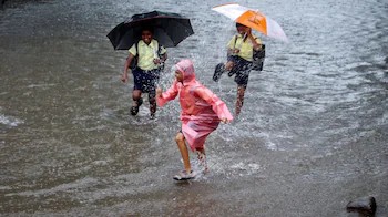
The delayed arrival of the monsoon has left Delhi under prolonged heat stress. The national capital recorded its warmest morning in two years, with the minimum temperature settling at 31.1 degrees Celsius, which was 3.2 degrees above normal. The maximum temperature rose to 41.8 degrees Celsius. The last time Delhi recorded a higher minimum temperature was on June 14, 2024, when it touched 33.3 degrees Celsius. The IMD said a heatwave was prevailing over the city and estimated the “feels-like” temperature at around 50.7 degrees Celsius at 5.30 pm. However, the department has forecast thunderstorms accompanied by rain for Monday. Private weather forecasting agency Skymet said the monsoon is expected to reach Delhi around July 4 if weather conditions remain favourable. Mahesh Palawat, Vice President (Meteorology and Climate Change) at Skymet, said the normal arrival date for the monsoon in Delhi is June 27 or 28, after which temperatures usually begin to fall. This year, however, the onset is likely to be delayed by about a week. “Dry westerly winds from Pakistan are keeping temperatures high, while southwesterly winds from the Arabian Sea are also reaching Delhi and increasing humidity,” Palawat said. Explaining the weather pattern, he said, “When these dry and moist air masses interact, clouds do form, but there is not enough moisture for widespread rainfall. By the time cloud formation takes place, usually around 4 or 5 pm, the day’s maximum temperature has already been recorded. That is why both the maximum temperature and the ‘feels-like’ temperature have remained unusually high.” In Himachal Pradesh, the meteorological centre in Shimla forecast a wet spell until July 4. A fresh western disturbance is expected to affect northwest India from July 2 onwards. The weather office issued an alert for thunderstorms and gusty winds of 30 to 40 kmph at isolated places between June 30 and July 4. Light rain was reported in parts of the state over the past 24 hours, while Shimla, Kangra and Mandi districts witnessed thunderstorms. Uttar Pradesh continued to experience scorching weather, with Prayagraj recording a maximum temperature of 43.4 degrees Celsius. Lucknow registered 39.7 degrees Celsius, which was 3.6 degrees above normal. The meteorological department said isolated areas of the state were likely to witness heatwave conditions over the next 24 hours. Thunderstorms, lightning and gusty winds are also expected at isolated places in eastern Uttar Pradesh. In Jammu and Kashmir, Srinagar recorded a maximum temperature of 33.8 degrees Celsius, 3.8 degrees above normal, while the minimum stood at 19.7 degrees Celsius, 2.6 degrees above normal. Jammu recorded a maximum of 37 degrees Celsius, while the minimum was 22.5 degrees Celsius, 3.8 degrees below normal. The weather office forecast pre-monsoon showers in the Jammu plains and adjoining areas on June 29, along with intense showers, thunderstorms and gusty winds at a few places. Temperatures also remained well above normal in Uttarakhand. Dehradun recorded a maximum temperature of 37.1 degrees Celsius, five degrees above normal, while the minimum settled at 26.8 degrees Celsius, three degrees above normal. The Dehradun Meteorological Centre issued a yellow alert for thunderstorms with lightning, intense to very intense rain spells and gusty winds at isolated locations in the hilly districts. For Punjab and Haryana, the IMD forecast scattered rainfall on June 29 and again on July 1 and 2. Thunderstorms, lightning and gusty winds reaching 40 to 50 kmph, with gusts up to 60 kmph, are likely between July 1 and 4, although temperatures are expected to remain above normal in several areas. In Rajasthan, humid conditions continued across much of the state. Scattered rain was reported in several districts, including Pilani in Jhunjhunu district, which received 7 mm of rainfall since morning. The weather department predicted moderate to heavy rain with thunderstorms in parts of the Kota and Udaipur divisions over the coming days, with rainfall activity likely to increase across southeastern and eastern Rajasthan from July 2.
Subsequent Advancement: Following its initial push, the monsoon system is tracking to progress across the rest of Uttar Pradesh, Himachal Pradesh, Jammu and Kashmir, Ladakh, and southeast Rajasthan over the subsequent days.
Why the Monsoon is Delayed
Meteorologists attribute the delayed seasonal progression to a combination of weak low-pressure systems over the Bay of Bengal and subdued Somalia jet stream winds, which failed to pull the rain systems northward at their standard pace. This stagnation created a prolonged gap, causing a significant cumulative rainfall deficit for June. After recording its hottest day in two years with the mercury touching 41.8°C, Delhi is still waiting for the much-anticipated monsoon. According to the IMD, favourable conditions could bring the southwest monsoon to the capital within the next five to six days, while Skymet estimates an arrival around July 4 if weather patterns remain supportive. Experts attribute the delay to weak low-pressure systems over the Bay of Bengal and subdued Somalia jet stream winds.