
The India Meteorological Department (IMD) has issued an Orange Alert for several southern and central districts of Kerala, forecasting very heavy rainfall driven by the active Southwest Monsoon. The India Meteorological Department (IMD) issued an orange alert in Thrissur, Kollam, Kottayam and Idukki districts for three hours from 4 pm.
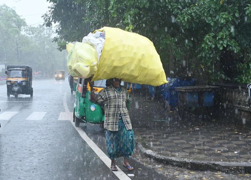
THIRUVANANTHAPURAM: With the onset of monsoon in Kerala drawing closer, the IMD on Saturday issued an orange alert in four districts for the evening as heavy rains lashed parts of the state. The India Meteorological Department (IMD) issued an orange alert in Thrissur, Kollam, Kottayam and Idukki districts for three hours from 4 pm in Thrissur, Kollam, Kottayam and Idukki districts.
Orange alert means very heavy rainfall of 11 cm to 20 cm.
It said that heavy rain and thunderstorm accompanied with gusty winds with speed reaching 40 to 60 kmph are likely at one or two places in these districts.
Additionally, the Meteorological Department has predicted light to moderate rain and thunderstorm accompanied with wind speed reaching up to 40 kmph at one or two places in Thiruvananthapuram, Pathanamthitta, Alappuzha, Ernakulam, Palakkad, Malappuram, Kozhikode, Wayanad and Kannur districts of the state.
The IMD recently forecast light to moderate rain with isolated heavy falls along with thunderstorms and gusty winds in various parts of Kerala till May 27.
It also predicted heavy to very heavy rainfall at isolated places over parts of Kerala between May 28 and June 3.
Here are the key details regarding the weather situation and safety guidelines:
🚨 Alert Details and Rainfall Intensity
- Orange Alert Districts: Very heavy rainfall between 11 cm and 20 cm is expected in districts including Thrissur, Kollam, Kottayam, and Idukki.
- Strong Winds: Rain will likely be accompanied by thunderstorms, lightning, and gusty winds reaching speeds of 40 to 60 km/h.
- Yellow Alert Districts: A Yellow Alert for moderate rainfall is in place for Thiruvananthapuram, Pathanamthitta, Alappuzha, Ernakulam, Palakkad, Malappuram, Kozhikode, Wayanad, and Kannur.
Thiruvananthapuram also known as Trivandrum, is the capital city of the Indian state of Kerala. Thiruvananthapuram, the capital city of Kerala. The district Located in the southwestern tip of India and is noted for internationally renowned beaches. Pathanamthitta is a Municipal Town in southern Kerala, India, spread over an area of 23.5 km 2 (9.1 sq mi). Under the three tier system of panchayat in rural areas, Pathanamthitta has one district panchayat, 8 block panchayat and 53 grama panchayats. Alappuzha or Alleppey is a municipality and town on the Laccadive Sea in the southern Indian state of Kerala. Alappuzha is the smallest district of Kerala having : North Latitudes – 9o 05′ and 9o 54′. East Longitudes – 76o 17′ 30″ and 76o 40′. Ernakulam is the central business district of the city of Kochi, Kerala, India. It is the namesake of Ernakulam district. Kerala Ernakulam is a district in the state of Kerala, India. A trove of. fascinating facts. Palakkad is often referred to as the Granary of Kerala due to its rich agricultural heritage and abundance of paddy fields. A trove of. fascinating facts. Palakkad is often referred to as the Granary of Kerala due to its rich agricultural heritage and abundance of paddy fields. Malappuram (also Malapuram) is a Municipal Town in Kerala and the headquarters of the Malappuram district in Kerala, India. Malappuram district is one of the 14 districts in the Indian state of Kerala, with a coastline of 70 km (43 mi). Framed by the Arabian Sea to the west and the Nilgiri hills to the east, Malappuram unfolds as a landscape of rolling hills, teak forests, rivers, and living. Kozhikode also known as Calicut, is a city along the Malabar Coast in the state of Kerala in India. The city is also known as the City of Spices. Kozhikode. This is a 4K Cinematic and Informative video of Kozhikode City. Kozhikode City is also known as Calicut. Wayanad district or Wynad, is a district in the north-east of the Indian state of Kerala, with its administrative headquarters at the municipality. Wayanad, the green paradise is nestled among the mountains of the Western Ghats, forming the border world of the greener part of Kerala. Kannur district derived its name from the location of its headquarters at Kannur town. The old name ‘Cannanore’ is the anglicised form of the Malayalam word. Kannur City, Kerala in Hindi. Kannur is a coastal city in the south Indian state of Kerala. It was once an ancient trading port.
Potential Risks and Safety Measures
Due to the continuous downpour, the Kerala State Disaster Management Authority (KSDMA) has issued the following safety advisories:
- Flash Floods and Waterlogging: Low-lying and urban areas may face severe waterlogging and localized flooding.
- Landslide Warning: Hilly and eco-fragile regions are prone to landslides and mudslides. Avoid night travel in these zones.
- Fishermen Advisory: Fishermen are strictly advised not to venture into the sea due to rough waters and high waves.
- River and Dam Safety: Stay away from rivers, bridges, and water reservoirs as water levels are expected to rise rapidly.
If you are located in the affected zones, stay tuned to local administration announcements and be ready to move to safer locations or relief camps if advised.
Rainfall
The Central Meteorological Department’s updated rainfall forecast for the next 5 days
The Central Meteorological Department has issued orange and yellow alerts in various districts.
Orange alert
24/05/2026: Ernakulam
The Central Meteorological Department has issued an orange alert for the district . It has predicted that there will be a possibility of very heavy rainfall in isolated places. The Central Meteorological Department defines Very Heavy Rainfall as rainfall ranging from 115.6 mm to 204.4 mm in 24 hours.
Yellow alert
24/05/2026 : Thiruvananthapuram, Kollam, Pathanamthitta, Alappuzha, Kottayam, Idukki, Thrissur, Malappuram, Kozhikode, Kannur, Kasaragod
25/05/2026: Pathanamthitta, Alappuzha, Kottayam, Idukki, Ernakulam, Thrissur, Malappuram, Kozhikode, Wayanad
26/05/2026: Thiruvananthapuram, Kollam, Alappuzha, Ernakulam
27/05/2026: Thiruvananthapuram, Kollam, Alappuzha
28/05/2026 : Thiruvananthapuram, Kollam, Pathanamthitta, Alappuzha, Kottayam, Ernakulam, Idukki
The Central Meteorological Department has issued a yellow alert for the districts . Isolated heavy rain is predicted. The Central Meteorological Department defines heavy rain (ISOL H) as a situation where rainfall of 64.5 mm to 115.5 mm is expected in 24 hours. Rainfall with thunderstorms is expected.
Cautionary advice to the public
Those living in areas prone to landslides, mudslides, and flash floods should move to safer places as directed by authorities.
Those living along riverbanks and downstream areas of dams should also anticipate the risk and evacuate as per the instructions of the authorities.
Those living in disaster-prone areas must ensure that camps are open in their area and move there during the day. For this, they can contact the local government and revenue authorities.
Due to the possibility of strong winds, those living in unsecured homes and those living in homes with weak roofs should exercise special caution. Those who are aware of the danger should contact the authorities and relocate to safer places as a safety precaution.
It is also important to be aware of the dangers that may arise from trees falling and posts collapsing in the wind.
Strong wind
Public safety tips to combat strong winds
Strong winds are the state-specific disaster that causes the most damage and loss of life in Kerala. There is a possibility of accidents due to uprooting of trees and breaking of branches in strong winds. During wind and rain, one should not stand under trees or park vehicles under any circumstances.
Dangerous branches of trees in the yard should be cut down. If you notice dangerous trees in public places, inform the relevant local bodies.
Unsecured billboards, electric posts, flagpoles, etc. are also prone to falling in the wind, so make sure to properly secure or dismantle them when there is no wind or rain. Do not stand under or near them or park vehicles when there is wind or rain.
Tools and other items that are likely to fall in the wind, such as ladders leaning against a wall or other object, should be tied down with ropes.
Windows and doors should be closed as soon as the wind starts blowing. Avoid standing near windows and doors. Avoid standing on the terrace of the house.
Those living in thatched, sheeted, or unsealed buildings should move to safer buildings as requested by authorities during warning periods.
Local self-government institutions, revenue officials, and public representatives should take the initiative to shift such people identified under the local body level disaster mitigation plan to relief camps at the required stages.
When the wind and rain become strong, there is a high risk of power lines and posts falling. If you notice any such accident, immediately inform the KSEB control room at 1912 or the District Disaster Management Authority control room at 1077. Avoid repairing the fault during the windy period and carry out it only after the wind and rain have stopped. The public should be patient and cooperate with the KSEB staff. The public should not go out and do such repair work directly.
Those who go to work early in the morning, such as newspaper and milk delivery people, should be especially careful. They should try to ensure that there are no power lines that have fallen in water bodies on the roads. If any danger is suspected, they should inform the control room and proceed only after ensuring that there is no danger.
Before entering the field, make sure that power lines that pass through farmland are safe.
Those engaged in construction work should stop work and move to a safe location when winds and rain become strong. During heavy rains, it is not permitted to cross rivers, bathe in rivers or other bodies of water, fish, or go for other purposes under any circumstances.
It is not allowed to climb over bridges above water bodies to enjoy the view, take selfies, or stand in groups.
Avoid all non-essential travel during periods of heavy rain. Excursions to waterfalls, water bodies, and hilly areas should be avoided until the rain warning is lifted.
Be especially careful when traveling on roads near water bodies. Be careful on roads under repair. The possibility of road accidents increases during heavy rains. Do not attempt to drive in areas where water bodies are overflowing.
Trees/posts/boards, walls, etc. that are in a dangerous condition in private and public spaces should be secured and trees should be pruned. Dangerous conditions should be brought to the attention of the authorities.
Those in disaster-prone areas should immediately prepare an emergency kit.

Kerala lashed by intense southwest monsoon; orange alert issued in multiple districts
Strong surface winds, with speeds reaching 50–60 kmph, were recorded in Thrissur, Ernakulam, Idukki, Kottayam, Wayanad, and Alappuzha IMD also stated that a low-pressure area is likely to form over the west-central and adjoining north Bay of Bengal around May 27.

THIRUVANTHAPURAM: Kerala witnessed an intense spell of the Southwest monsoon, with 11 districts reporting extremely heavy rainfall at isolated locations. The India Meteorological Department (IMD) has issued an orange alert for Thiruvananthapuram, Kollam, and Alappuzha.
Strong surface winds, with speeds reaching 50–60 kmph, were recorded in Thrissur, Ernakulam, Idukki, Kottayam, Wayanad, and Alappuzha. The heavy rains caused widespread disruption, including damage to homes, uprooted trees, and waterlogging across multiple districts.
Urumi in Kozhikode recorded the highest rainfall at 21 cm, followed closely by Ayyankunnu in Kannur with 20 cm.
The IMD has also forecast the formation of a low-pressure area over the west-central and adjoining north Bay of Bengal around 27 May. Strong westerly winds are expected to persist in the lower tropospheric levels over Kerala and the Lakshadweep region throughout the coming week.
Rain or thundershowers are likely at most places across the state until 1 June, with isolated thunderstorms accompanied by lightning forecast through 27 May. A high wave alert has also been issued along the Kerala coast during this period. If you are located in the affected zones, stay tuned to local administration announcements and be ready to move to safer locations or relief camps if advised.
Kerala braces for heavy rainfall as IMD issues orange alert on Sunday issued an orange alert in two districts as heavy rain was reported in various parts of Kerala.
The IMD declared an orange alert for Pathanamthitta and Alappuzha districts, indicating the possibility of very heavy rainfall ranging from 115.6 mm to 204.4 mm in 24 hours at isolated places.
A yellow alert has been issued for Thiruvananthapuram, Kollam, Kottayam, Ernakulam, Idukki, Kozhikode, Wayanad, Kannur and Kasaragod, warning of heavy rainfall between 64.5 mm and 115.5 mm.
On May 18, a yellow alert has been sounded in Pathanamthitta, Alappuzha, Kottayam, Idukki, Ernakulam, Thrissur, Palakkad and Malappuram districts, while on May 19 it will be in force in Malappuram, Kozhikode, Wayanad, Kannur and Kasaragod.
The Kerala State Disaster Management Authority (KSDMA), in a statement, urged people living in landslide- and flood-prone areas to remain vigilant and move to safer locations as per official instructions.
Residents along riverbanks and downstream areas of dams have also been advised to exercise caution and relocate if necessary.
People in vulnerable areas have been asked to ensure that relief camps are operational and shift during daytime if required, in coordination with local and revenue authorities, the statement said.
Given the likelihood of strong winds, those living in weak or poorly secured houses have been advised to take precautions or move to safer places.
The authorities also warned against crossing rivers, entering water bodies for bathing or fishing, or venturing onto bridges over swollen rivers during heavy rainfall.
Unnecessary travel should be avoided, especially to hilly areas, waterfalls and water bodies, until the weather warning is lifted, they said.
Motorists have been advised to exercise caution on roads near water bodies and avoid driving through flooded stretches.
People have also been urged to secure loose trees, electric posts, hoardings and walls in both private and public spaces and report potential hazards to authorities.

Heavy rainfall expected in parts of southern Kerala, orange alert in one district, yellow in 6 orange alert means very heavy rain of 11 cm to 20 cm, while a yellow alert means heavy rainfall between 6 cm and 11 cm on Friday predicted heavy rainfall in the southern parts of Kerala, issuing an orange alert in one district and a yellow alert in six others for the day.
The India Meteorological Department (IMD) issued an orange alert in the coastal Alappuzha district.
THIS AD SUPPORTS OUR JOURNALISM.
It issued a yellow alert in Thiruvananthapuram, Kollam, Pathanamthitta, Kottayam, Ernakulam and Idukki districts of the state.
An orange alert means very heavy rain of 11 cm to 20 cm, while a yellow alert means heavy rainfall between 6 cm and 11 cm.
Besides that, the IMD has predicted widespread light to moderate rainfall with isolated instances of heavy rainfall accompanied by thunderstorms and gusty winds in various parts of Kerala till May 27.
THIS AD SUPPORTS OUR JOURNALISM.
It has also predicted isolated heavy to very heavy rainfall over parts of Kerala between May 28 and June 3.
As a result of the heavy rainfall, moderate flash floods, localised flooding of roads, water logging in low lying areas in urban areas, disruptio of traffic in major cities, isolated incidents of landslides or mudslides, etc. were likley in various parts of the state, the IMD has said.


Monsoon may arrive in Kerala on May 26; find out where it will be hot and where it will rain heavily.Monsoon nears its entry into Kerala, rain in North, East and South India, storm alert; heatwave continues in several states, hot nights in Madhya Pradesh and Vidarbha.

Summary
- Monsoon may reach Kerala by May 26, rain and thunderstorms expected in several states, heat wave likely to continue in North India
- Heavy rain alert in Bihar, Jharkhand and northeastern states, warning of strong winds and lightning
- Heatwave threat in Uttar Pradesh, Rajasthan and Madhya Pradesh, people advised to avoid going out in the afternoon
- Monsoon activity intensifies in Andaman and Nicobar Islands, fishermen warned of high seas
- Heavy rain and thunderstorms are expected in Kerala, Tamil Nadu and Karnataka for the next few days.
The weather in many parts of the country is expected to remain unpredictable for the next few days.
Western Disturbances

Hot winds and scorching sun have made life difficult for the people. The situation is such that by afternoon the roads start appearing deserted and people are forced to remain confined to their homes.
May heat broke records
This year’s heat wave in May has shattered many previous records. Temperatures in Banda district of Uttar Pradesh set a new record. According to the Meteorological Department, Brahmapuri in Maharashtra recorded the highest temperature of 47.2 degrees Celsius. Along with the days, nights are also becoming extremely hot. Hot winds and humidity are affecting people’s sleep.
The situation remains particularly severe in Delhi. The Meteorological Department predicts that the heat in the capital could reach its peak today, May 25th. In many areas, the mercury could hover around 45 degrees. However, light rain and strong winds are also expected in some areas. Wind speeds could reach 65 kilometers per hour in the evening.
Relief may be available after May 30
According to the Meteorological Department, temperatures in northwest India will remain unchanged until May 28. After this, temperatures may drop by three to five degrees Celsius on May 29 and 30. Temperatures in Punjab are expected to rise until May 26, with gradual relief expected after that.
Temperatures in eastern India are expected to begin to drop starting May 27. Central India may also experience a slight decrease in heat after May 29. However, the weather in the rest of the country is expected to remain largely the same until May 30.
Heatwave alert issued in several states
Rain and thunderstorms are expected in many states
While North India is sweltering in the heat, warnings of heavy rain and thunderstorms have been issued for many parts of the country. The state government has issued an orange alert for rainfall here. These states could receive between 115.6 and 204.4 mm of rain. Strong winds of up to 50 to 60 kilometers per hour are expected in Jharkhand and Odisha. People have been advised to stay away from trees and power poles during the inclement weather.
Warning for sea areas
Fishermen have been warned against venturing into the sea due to the possibility of strong winds in the Arabian Sea and the Bay of Bengal. Winds of 40 to 60 kilometers per hour are expected in the coastal areas of Kerala, Karnataka, and Lakshadweep.
The weather department has said that rough sea conditions could cause damage to small boats and fishing vessels, so fishermen need to remain vigilant for the next few days.
Hope for increased monsoon
According to the Meteorological Department, the monsoon is expected to advance into more parts of the Arabian Sea, the Bay of Bengal, and the Andaman Sea over the next two to three days.
With the monsoon’s activity increasing, many parts of the country may experience relief from the heat. Farmers are also eagerly awaiting the monsoon, as good rainfall will benefit agriculture.
Important advice for people and farmers
Due to the intense heat, people have been advised to avoid leaving their homes between 11 a.m. and 4 p.m. If necessary, they should cover their heads with a cloth or hat and drink plenty of water.
It is crucial to maintain hydration. Consuming lemon water, buttermilk, coconut water, and ORS is considered beneficial. Wearing light, cotton clothing is recommended.
Providing shade and adequate water for livestock has been emphasized. Where heavy rain is expected, proper drainage systems have been recommended in fields.
Varying weather patterns across the country are posing significant challenges. In some places, intense heat is causing distress, while elsewhere, rain and storms are adding to the woes. In such a situation, caution and vigilance are considered the best defense.
Where did it rain in the last 24 hours?
In the last 24 hours, good rains have been recorded in many states including Northeast India, Kerala and Karnataka, Tezpur recorded the highest rainfall of 5 cm. Rains are active from Assam and Meghalaya to Goa, heavy rains in many areas have made the weather pleasant. Widespread rains have been recorded in the South and Northeast parts of the country, good rains have also been recorded in Lakshadweep and Tripura. Pre-monsoon rains have been intense in many states, Tezpur, Minicoy and Agartala have recorded four to five cm of rain. Thunderstorms and strong winds with speeds of up to 40 to 50 km per hour are expected in these areas. A thunderstorm and rain warning has also been issued for eastern parts of Rajasthan.
Heavy rain alert in Northeast India
Rainfall is expected to continue for the next several days in several states of Northeast India. These states may receive rainfall ranging from 64.5 to 115.5 mm. A yellow alert has been issued for rain here.
According to the Meteorological Department, heavy rain is expected in Arunachal Pradesh on May 16, 17, 20, and 21. Heavy rain is also expected in many areas of Assam and Meghalaya until May 21.
Thunderstorms are expected in Bihar, Jharkhand and Bengal.
Active weather conditions will also prevail in eastern India. Light to moderate rain and strong winds are expected in many parts of Bihar, Jharkhand, Odisha, and West Bengal. Strong thunderstorms with winds of up to 50 to 70 kmph are expected in parts of Bihar and Jharkhand.
Sub-Himalayan West Bengal and Sikkim are expected to experience heavy rainfall between May 16 and 18. A warning for very heavy rainfall and strong winds has also been issued for the Andaman and Nicobar Islands. The Meteorological Department has issued a yellow alert for rainfall in these states, which may receive between 64.5 and 115.5 mm of rainfall. Fishermen have also been advised not to venture into the sea due to the potential for high waves due to the low pressure.
Weather will also change in Central and West India
Chhattisgarh may experience light rain and thunderstorms on May 16 and 17. Rain and strong winds are also expected in many parts of Maharashtra, including Konkan, Goa, Marathwada, and Central Maharashtra, over the next few days.
A slight drop in temperature may be recorded in Gujarat, while in Maharashtra, the temperature is expected to drop by two to three degrees after May 19.
Thunderstorms and heavy rains in South India
Heavy rain is expected in parts of Tamil Nadu, Puducherry, Kerala, and South Interior Karnataka. Rainfall amounts of 64.5 to 115.5 mm are expected here. A yellow alert for rain has been issued for these states as well. Farmers and the public have been advised to remain vigilant due to the continuous downpour.
Monsoon likely to reach Kerala by May 26, weather favourable for Andaman
According to the Meteorological Department, the southwest monsoon is expected to reach Kerala around May 26th. However, a four-day delay is also possible. If the forecast is correct, the monsoon will enter India around its normal time.
Meteorologists say the monsoon is advancing rapidly due to favorable weather conditions developing in the Arabian Sea and the Bay of Bengal. As a result, many parts of South India are already experiencing cloudy weather, rain, and strong winds.
Signs of onset of monsoon in Andaman and Nicobar
The Meteorological Department has stated that conditions have become favorable for the advance of the southwest monsoon into parts of the south Bay of Bengal, the Andaman Sea, and the Andaman and Nicobar Islands from today, May 16, 2026. These areas are experiencing persistent cloud cover, strong winds, and increased rainfall activity.
Usually, the monsoon first reaches the Andaman and Nicobar regions and then gradually moves towards Kerala.
