
For much of July, the monsoon has behaved like a guest who arrived, unpacked, and then quietly stopped showing up for dinner.
The clouds thinned, the plains simmered, and the rain retreated towards the Himalayan foothills. Now, the India Meteorological Department (IMD) says the wait is nearly over. The monsoon is preparing a strong comeback.
WHEN AND WHERE WILL IT RAIN NEXT WEEK?
The revival is expected to begin over Northeast India and then spread to East, Central and North India early next week.
Widespread showers and thunderstorms are likely, with heavy rain in some places. For the Gangetic plains and Central India, which have spent weeks under a hot, sticky haze, this will be the first real relief of the month. For much of July, the monsoon has behaved like a guest who arrived, unpacked, and then quietly stopped showing up for dinner.
The clouds thinned, the plains simmered, and the rain retreated towards the Himalayan foothills. Now, the India Meteorological Department (IMD) says the wait is nearly over. The monsoon is preparing a strong comeback.
WHEN AND WHERE WILL IT RAIN NEXT WEEK?
The revival is expected to begin over Northeast India and then spread to East, Central and North India early next week.
Widespread showers and thunderstorms are likely, with heavy rain in some places. For the Gangetic plains and Central India, which have spent weeks under a hot, sticky haze, this will be the first real relief of the month.
WHAT WILL BRING THE RAIN BACK?
The engine of the comeback is a fresh low-pressure area forming over the Bay of Bengal.
A low-pressure area is a patch of the atmosphere where air rises. As it rises, it behaves like a giant vacuum cleaner, sucking in moist winds from the sea and organising them into rain-bearing clouds.
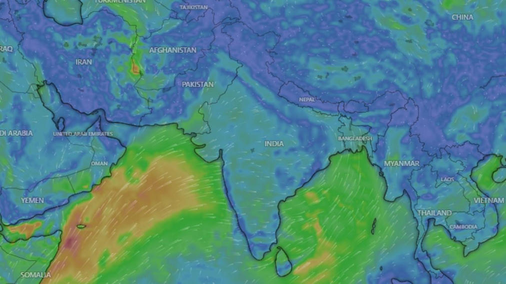
Monsoon set for a strong comeback: When and where will it rain next week?
As this system drifts inland across the east coast towards Central India, it will drag the monsoon trough back into position. The trough is an elongated line of low pressure stretching across northern India, and it works as the spine of the monsoon. Where the trough sits, the rain follows. For weeks, this spine had shifted north towards the Himalayan foothills. That is why the hills received heavy rain while the plains stayed dry. Once the trough returns south, moist winds from both the Bay of Bengal and the Arabian Sea are expected to push deep inland, feeding rain across a much wider area.
WHY DID THE MONSOON GO QUIET IN JULY?
India has been in what meteorologists call a break monsoon phase, a well-known lull in which the trough drifts north and Central India dries out.
Very few low-pressure systems formed over the Bay of Bengal this month, the moisture-carrying winds from the Arabian Sea weakened, and sinking air over the country suppressed cloud growth.
The result is a nationwide rainfall deficit of 24 per cent so far, with India receiving 244.6 mm of rain against a normal of 323.1 mm.
WHY HAS IT FELT SO HOT WITHOUT RAIN?
Because the moisture never left, only the clouds did. Strong sunshine heated the land, while high humidity stopped sweat from evaporating efficiently, pushing the “feels-like” temperature, or heat index, above 40 degrees Celsius in many cities.
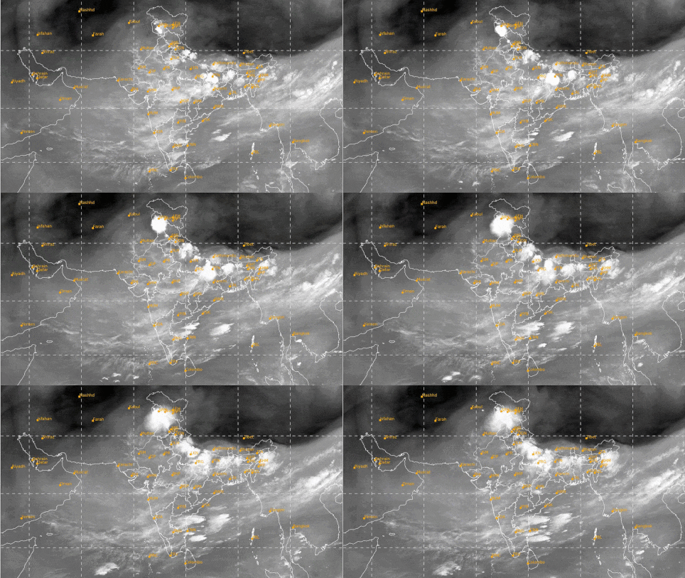
Understanding the soil water dynamics during excess and deficit rainfall conditions over the Core monsoon zone of India Observations of soil moisture (SM) during excess and deficit monsoon seasons between 2000 to 2021 present a unique opportunity to understand the soil water dynamics (SWD) over core monsoon zone (CMZ) of India. This study aims to analyse SWD by investigating the SM variability, SM memory (SMM), and the coupling between the surface and subsurface SM levels. Particularly intriguing are instances of concurrent monsoonal extremes, which give rise to complex SWD patterns. Usually, it is noted that a depleted convective activity and persistence of higher temperatures during the pre-monsoon season leads to lower SM, while monsoon rains and post-monsoon showers support the prevalence of higher SM conditions. The long persistent dry spells during deficit monsoon years enhances the Bowen ratio (BR) due to the high sensible heat fluxes. On the other hand, the availability of large latent heat flux during excess monsoon and post-monsoon seasons tends to decrease the BR. This enhancement or reduction in BR is due to evapotranspiration (ET), which influences the SWD by modulating the surface subsurface SM coupling. The surface and subsurface SM coupling analysis for CMZ exhibits significant distinction in the evolution of wet and dry extremes. SM variations and persistence time scale is used as an indicator of SMM, and analysed for both surface and subsurface SM observation levels. Evidently, subsurface SM exhibits remarkably prolonged memory timescales, approximately twice that of surface SM. Furthermore, we dissect SWD linked to wet and dry extremes by analysing annual soil water balance (SWB). Our findings reveal augmented (diminished) ET during deficit (excess) years, subjected to a higher (lower) number of break events. In essence, our study underscores the significance of surface-subsurface SM observations in unravelling the intricate tapestry of SWD. IS ONE WEEK OF RAIN ENOUGH?
No. Next week’s burst will cool the plains and help farmers sow rice, soybean, cotton and pulses. But erasing a seasonal shortfall needs sustained, widespread rain over several weeks.
The real test for this monsoon begins now, and August will decide how the season is remembered.
The Southwest Monsoon covered the entire country on 9th July: The Southwest
Monsoon further advanced into remaining parts of north Arabian Sea, Rajasthan, Haryana
and Punjab on 9th July. Thus, it has covered the entire country on 9th July, 2026, against
the normal date of 8th July (1 day after the normal date of covering the entire India).
Subdued rainfall activities over central and south peninsular India during the week
leading to all-India weekly cumulative rainfall 51% below normal of long-period average.
Last week’s Well-Marked Low Pressure Area over northwest Madhya Pradesh & adjoining
southwest Uttar Pradesh lay over southwest Uttar Pradesh & neighbourhood on 9th July
and lay as a Low Pressure Area over northern parts of central Uttar Pradesh in the morning
hours of 10th July and became less marked in the morning hours of 11th July. It caused
isolated extremely heavy rainfall over Uttarakhand, West Uttar Pradesh on 9th & 10th
July, Himachal Pradesh on 10th July and heavy to very heavy rainfall at isolated places
over East Uttar Pradesh during 10th – 13th July, Haryana, East Madhya Pradesh, Bihar on
10th July, Himachal Pradesh, Uttarakhand on 11th July.
Formation of a Low Pressure Area over Northwest Bay of Bengal off north Odisha –
West Bengal coasts on 15th July: Under the influence of an upper air cyclonic circulation
over North Bay of Bengal & adjoining south Bangladesh, a Low Pressure Area formed over
Northwest Bay of Bengal off north Odisha -West Bengal coasts in the morning hours of 15th
July.
Extremely heavy rainfall also recorded at isolated places over Assam & Meghalaya on 9th
& 12th July, Madhya Maharashtra on 9th July, Sub-Himalayan West Bengal & Sikkim on
13th July. Heavy to very heavy rainfall also recorded at isolated places over SubHimalayan West Bengal & Sikkim on 9th & 10th July, Nagaland, Manipur, Mizoram &
Tripura on 9th, 13th & 15th July, Tamil Nadu, Puducherry & Karaikal, Konkan & Goa on 9th
July, Assam & Meghalaya on 10th, 11th & 13th July, Bihar on 13th & 14th July, Odisha on
14th & 15th July.
Heavy rainfall recorded at isolated places over East Uttar
The Southwest Monsoon covered the entire country on 9th July: The Southwest
Monsoon further advanced into remaining parts of north Arabian Sea, Rajasthan, Haryana
and Punjab on 9th July. Thus, it has covered the entire country on 9th July, 2026, against
the normal date of 8th July (1 day after the normal date of covering the entire India).
Subdued rainfall activities over central and south peninsular India during the week
leading to all-India weekly cumulative rainfall 51% below normal of long-period average.
Last week’s Well-Marked Low Pressure Area over northwest Madhya Pradesh & adjoining
southwest Uttar Pradesh lay over southwest Uttar Pradesh & neighbourhood on 9th July
and lay as a Low Pressure Area over northern parts of central Uttar Pradesh in the morning
hours of 10th July and became less marked in the morning hours of 11th July. It caused
isolated extremely heavy rainfall over Uttarakhand, West Uttar Pradesh on 9th & 10th
July, Himachal Pradesh on 10th July and heavy to very heavy rainfall at isolated places
over East Uttar Pradesh during 10th – 13th July, Haryana, East Madhya Pradesh, Bihar on
10th July, Himachal Pradesh, Uttarakhand on 11th July.
Formation of a Low Pressure Area over Northwest Bay of Bengal off north Odisha –
West Bengal coasts on 15th July: Under the influence of an upper air cyclonic circulation
over North Bay of Bengal & adjoining south Bangladesh, a Low Pressure Area formed over
Northwest Bay of Bengal off north Odisha -West Bengal coasts in the morning hours of 15th
July.
Extremely heavy rainfall also recorded at isolated places over Assam & Meghalaya on 9th
& 12th July, Madhya Maharashtra on 9th July, Sub-Himalayan West Bengal & Sikkim on
13th July. Heavy to very heavy rainfall also recorded at isolated places over SubHimalayan West Bengal & Sikkim on 9th & 10th July, Nagaland, Manipur, Mizoram &
Tripura on 9th, 13th & 15th July, Tamil Nadu, Puducherry & Karaikal, Konkan & Goa on 9th
July, Assam & Meghalaya on 10th, 11th & 13th July, Bihar on 13th & 14th July, Odisha on
14th & 15th July.
Heavy rainfall recorded at isolated places over East Uttar Pradesh on 9th, 14th & 15th July,
East Rajasthan, West Madhya Pradesh on 9th & 10th July, Bihar on 9th, 11th, 12th & 15th
July, Arunachal Pradesh on 9th, 13th & 15th July, West Rajasthan, East Madhya Pradesh,
Vidarbha on 9th July, Punjab Haryana on 10th & 11th July, Gangetic West Bengal on 10th,
11th, 13th & 14th July, Nagaland, Manipur, Mizoram & Tripura on 10th, 11th & 14th July,
Jharkhand on 11th & 15th July, Odisha, West Uttar Pradesh, Tamil Nadu, Kerala & Mahe
on 11th July, Uttarakhand on 12th, 13th & 15th July, Sub-Himalayan West Bengal & Sikkim
on 12th & 14th July, Himachal Pradesh on 13th July, Assam & Meghalaya on 14th & 15th
July.
During the past week (09 to 15 July 2026), rainfall was below normal over the country as a
whole (51% below Long Period Average (LPA)) and all the homogeneous regions of India
(Annexure I).
Cumulatively from 1 June to 15 July 2026, the country as a whole has had rainfall below
normal by 23% of LPA (Annexure II).
Details of weekly and cumulative rainfall distribution are given in Table 1.
Page 2 of 11
Table 1: Rainfall status (Week and season)
Region Week Season
09.07.2026 TO 15.07.2026 01.06.2026 TO 15.07.2026
Actual
(mm)
Normal
(mm)
Departure
(%)
Actual
(mm)
Normal
(mm)
Departure
(%)
EAST & NORTHEAST
INDIA 78 100.8 -23% 348 540.2 -36%
NORTHWEST INDIA 35.7 49.1 -27% 137.5 168.7 -19%
CENTRAL INDIA 16.9 69.8 -76% 273.2 315 -13%
SOUTH PENINSULA 10.8 46.4 -77% 190 255.3 -26%
THE COUNTRY AS A
WHOLE 31.2 63.8 -51% 227.0 294.2 -23%
- Large-scale features:
El Niño conditions prevail over the equatorial Pacific Ocean, with sea surface temperature
(SST) anomalies remaining above normal across the central and eastern equatorial Pacific.
These conditions are expected to strengthen further during the Southwest Monsoon season.
Forecasts from the Monsoon Mission Coupled Forecast System (MMCFS) also indicate a
continued strengthening of El Niño conditions throughout the Southwest Monsoon season.
Neutral Indian Ocean Dipole (IOD) conditions prevail over the Indian Ocean. Forecasts from
the Monsoon Mission Coupled Forecast System (MMCFS) indicate that these neutral IOD
conditions are likely to persist throughout the Southwest Monsoon season.
Madden-Julian Oscillation (MJO) index is currently in phase 8 with an amplitude of more
than 1. It is likely to continue in the same phase, with a decreasing trend in amplitude
during week 1 and on most days of week 2. During the latter half of week 2, it is likely to
enter phase 1 with an amplitude nearing 1. - Forecast for the next two weeks
Weather systems & associated Precipitation during Week 1 (16 to 22 July 2026) and
Week 2 (23 to 29 July 2026)
Weather systems & associated Precipitation during Week 1 (16 to 22 July 2026):
Weather systems during week 1:
A well-marked low-pressure area lay over the Northwest Bay of Bengal and adjoining North
Odisha -West Bengal coast. It is likely to move northwestwards across North Odisha &
Gangetic West Bengal during the next 2 days and weaken gradually.
The western end of the monsoon trough is likely to remain north of its normal position and
the eastern end near its normal position during the week.
The low-level Somali Jet is likely to prevail during the week.
Strong northwesterly winds are likely to prevail over the southern peninsular India and
central India during most days of the week.
An anomalous ridge is likely to extend from the central Arabian Sea to the southwest Bay of
Bengal across Karnataka and Andhra Pradesh during the week in lower tropospheric levels.
Two Western Disturbance likely to affect northwest India during some days of week 1.
Page 3 of 11
The Tibetan Anticyclone is likely to shift westward during the week and remain positioned
roughly around 30-32°N latitude.
A ridge is likely to prevail in upper tropospheric levels around 30°N latitude during the
week.
The Tropical Easterly Jet is likely to be weak over South Peninsular India during the week.
Under the influence of the above systems, the following weather is likely:
Subdued rainfall activity is likely over west-central and south Peninsular India during the
week and over the plains of northwest India during the next 2 days.
Isolated heavy to very heavy rainfall is likely over Jammu & Kashmir, Himachal Pradesh,
Uttarakhand, Punjab, Haryana, Chandigarh & Delhi, and West/East Uttar Pradesh during
the week. Very heavy rainfall is likely over Jammu & Kashmir (21 July), Himachal
Pradesh (19–22 July), Uttarakhand (18–21 July), and East Uttar Pradesh (19–21 July).
Isolated heavy rainfall is likely over Chhattisgarh, East Madhya Pradesh, and Vidarbha
during the week. Very heavy rainfall is likely over Chhattisgarh on 16 July.
Isolated heavy rainfall is likely over Bihar, Sub-Himalayan West Bengal & Sikkim,
Gangetic West Bengal, Jharkhand, and Odisha during the week. Very heavy rainfall is
likely over Bihar, Sub-Himalayan West Bengal & Sikkim (18–20 July), and Odisha (17
July), while isolated extremely heavy rainfall is likely over Odisha on 16 July.
Widespread heavy rainfall is likely over Arunachal Pradesh, Assam & Meghalaya,
Nagaland, Manipur, Mizoram & Tripura during the week. Very heavy rainfall likely over
Arunachal Pradesh (17–19 July) and Assam & Meghalaya (16–19 July).
Isolated heavy rainfall is likely over Konkan & Goa, Madhya Maharashtra & Coastal
Andhra Pradesh & Yanam on 16 July.
Thunderstorm activity accompanied by lightning, gusty winds, and isolated thundersquall
activity is likely over parts of Central India, East India, Northeast India, Northwest Plains,
Peninsular India, West Coast, West India, and Western Himalayan Region during the week.
Overall, rainfall activity is likely to be normal to above normal over most parts of
East and Northeast India and below normal over the rem
